Using remote sensing to improve canegrub management in North Queensland cane fields
| Date Accessioned | 2017-03-05 |
| Date Available | 2017-03-05 |
| Issued | 2017 |
| Identifier | http://hdl.handle.net/11079/16174 |
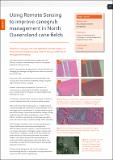
| Abstract | Research is hoping to use more affordable satellite imagery to bring cane grub mapping a step closer to being a viable tool for the sugarcane industry. |
| Language | en |
| Publisher | Sugar Research Australia Limited |
| Part of Series | Autumn 2017 p 15 |
| Subject | Pest management |
| Subject | Remote Sensing technology |
| Title | Using remote sensing to improve canegrub management in North Queensland cane fields |
Files in this item
This item appears in the following Collection(s)
-
CaneConnection articles [450]
CaneConnection articles in pdf format